 EcorisMap
CHAPTER 16
App Settings
The Settings screen, opened with the “settings” button, is where you save and load data and configure the app as a whole.
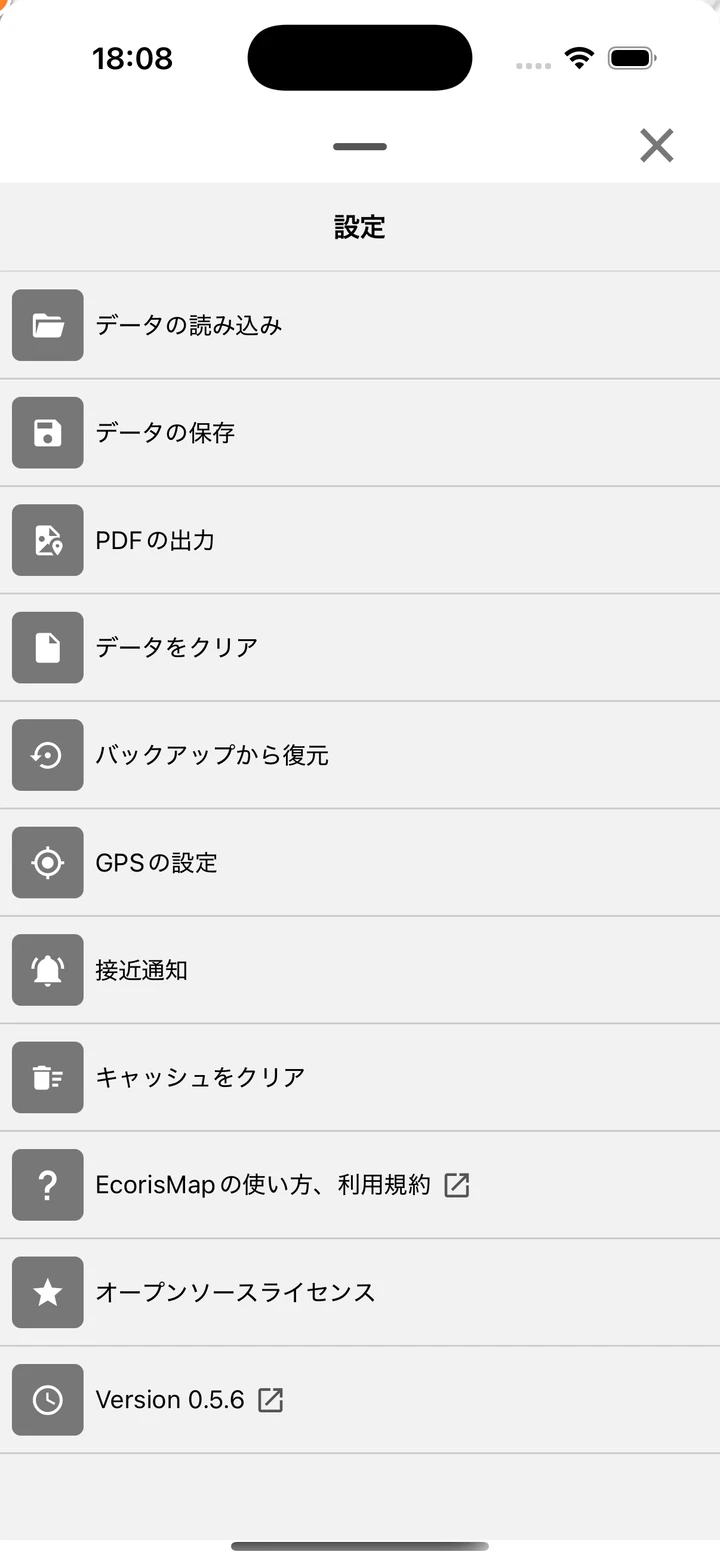
- Load data — See Import Data.
- Save data — See Export Data.
- PDF output — See Output PDFs.
- GPS settings and Proximity Alert — See Use GPS.
Restore from backup (mobile version only)
A backup is automatically created just before any operation that loses data. Use “Restore from backup” on the Settings screen to bring it back.
When automatic backups are created: before closing a project / before opening a project / before clearing data / before loading a file / before restoring
Up to the latest 5 generations are kept. No backup is created when there is 0 data.
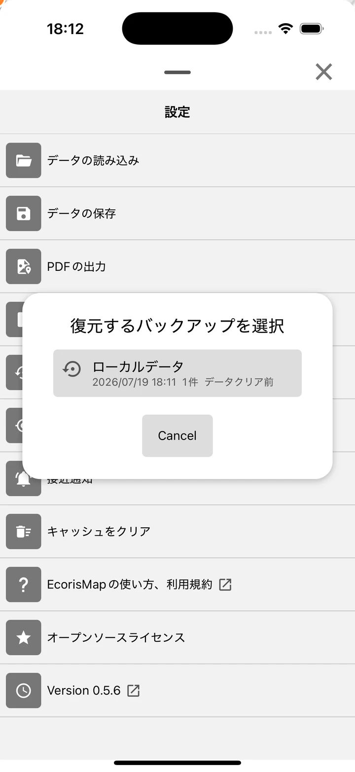
Restore steps
- Tap “Restore from backup” and choose the backup to restore from the list. Each entry shows the project name or “Local data”, the date/time, the number of records, and the creation timing.
- Run it with “Restore the selected backup? Current data will be replaced. (The current state will also be backed up automatically.)”.
- After restoring, if you sync the project (upload/download), you may need to log in again while online.
Note: The contents of the dynamic dictionary are not included in backups.
Deleting backups
Use the delete button on each row to remove a single backup, or “Delete all” to remove every backup on the device (including backups of other accounts not shown in the list). Both ask for confirmation, and deletion cannot be undone. Use this when you do not want to leave restorable data on the device, for example before handing it over.
Clear data
After you confirm “Clear current data?”, the data, layers, added maps, and settings return to their initial state.
- An automatic backup is created just before clearing.
- The photo and map download caches and your acceptance of the terms of use are not deleted.
Clear cache
After you confirm “Clear all cache (maps and photos)?”, the app deletes the downloaded map tiles and the photo cache. Recorded data and layers are not deleted.
Language
Switches the app’s display language. Choose from “Follow system settings”, “日本語”, or “English” (the default follows the system settings).
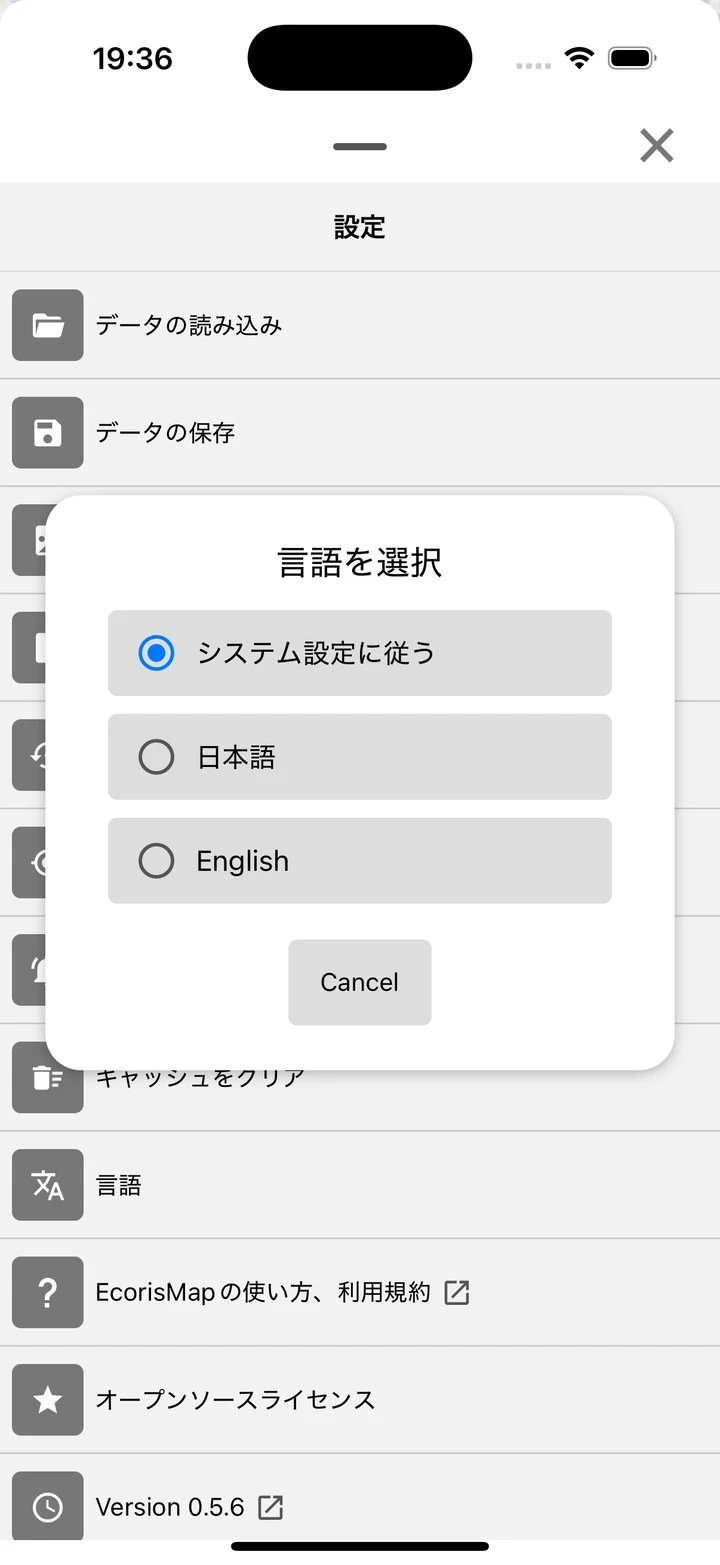
- On mobile, the change takes effect after restarting the app. The web version reloads automatically.
Other
- Manual and Terms of use — Opens this manual and the terms of use in a browser.
- Open Source License — Displays a list of licenses for the open source software used.
- Version — Displays the current version. Tapping it opens the change history (CHANGELOG) in a browser.