 EcorisMap
CHAPTER 12
Output PDFs
You can export the map and data for a specified extent as a geospatial PDF. The exported PDF loads directly into GIS software such as QGIS, and you can print it as a paper map. You can also output a table listing your data as a PDF.
| PDF output mode | Output settings |
|---|---|
 |  |
Export steps
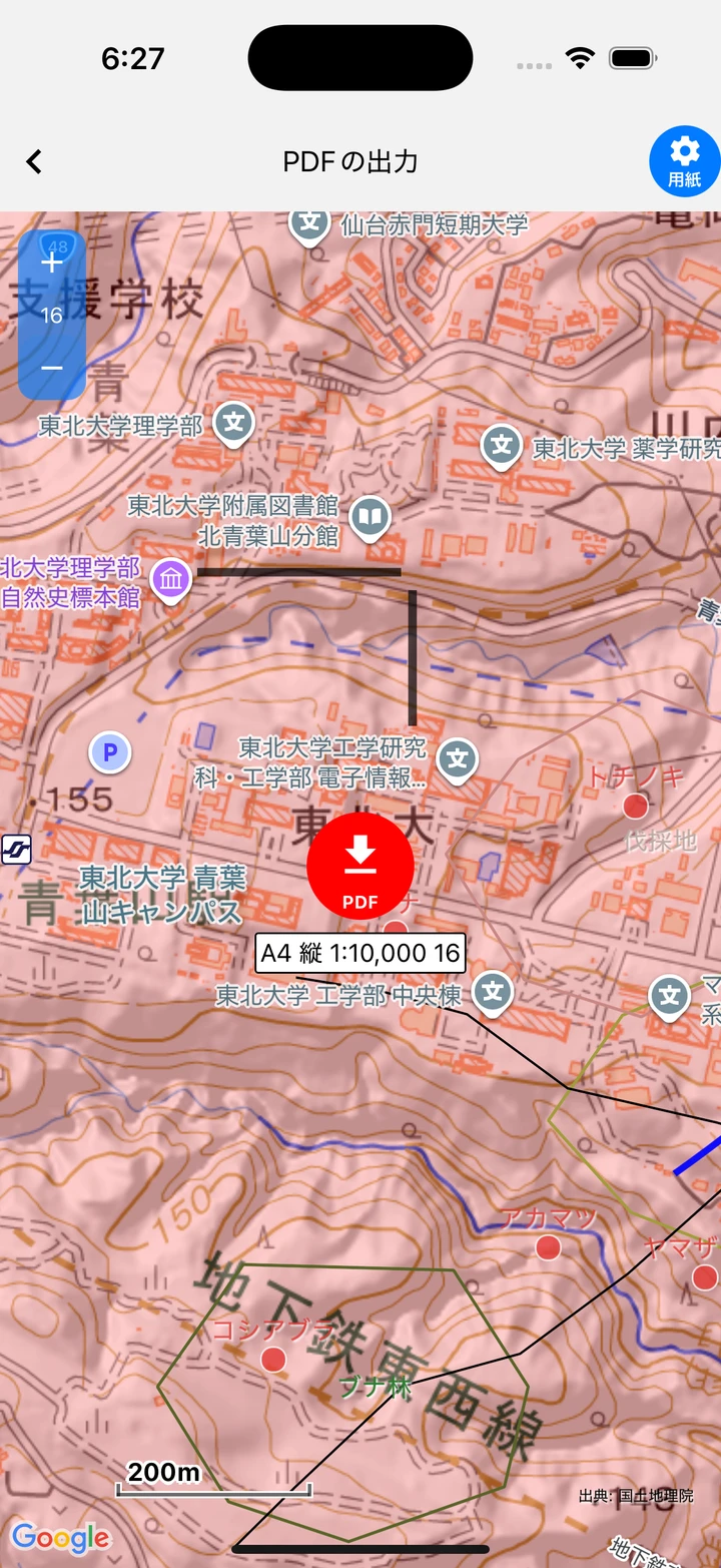
- Tap “PDF output” on the Settings screen. The Home screen switches to PDF output mode and shows the output extent (the paper extent) with a red frame.
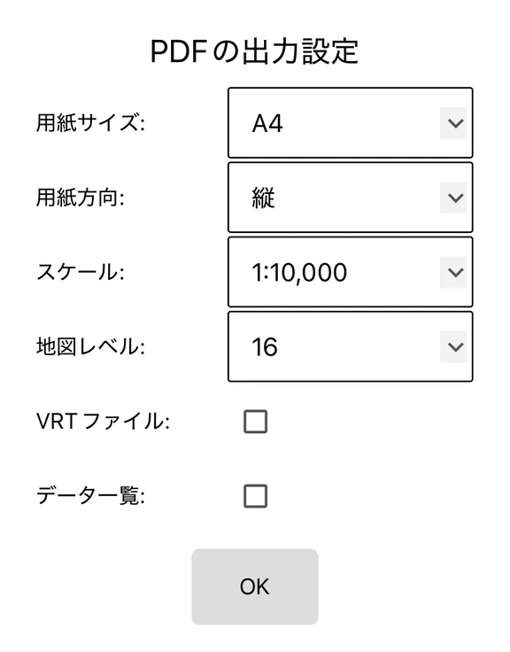
- Open the “PDF output settings” with the gear (paper) button at the top right.
| Item | Options |
|---|---|
| Paper size | A4 / A3 / A2 / A1 / A0 |
| Paper orientation | Portrait / Landscape |
| Scale | 1:500 to 1:100,000 (9 levels) |
| Map level | Choose from candidates based on the paper size and scale (auto-set available) |
| VRT file | Also outputs a VRT file for loading into GIS |
| Data list | Outputs the data table as a PDF |
- Move the map to the extent you want to export, and tap the “PDF” button to export.
- In the mobile version, a share sheet opens where you select the destination or app. If “Data list” was turned on, the data PDF is shared after the map PDF. In the web version, save the PDF from the browser’s print dialog.
Contents of the exported PDF
- The PDF draws map tiles, points, lines, polygons, map memos (including arrows), symbols such as flight-map marks, labels, a north arrow, a scale bar, and the source.
- The coordinate system is Web Mercator (EPSG:3857), and georeferencing information is embedded.
- The output file name is
ecorismap_map_datetime.pdf. The data list is namedecorismap_data_datetime.pdf.
Notes
- Google maps (Standard map / Satellite image) are not exported. If a Google map is set as the background, the PDF background will be empty. Please use a tile map such as a GSI map.
- When using a PDF exported in the web version in GIS, use the VRT file together with it.
- An exported geospatial PDF can be re-imported into EcorisMap as a map (see Set Up Maps).