 EcorisMap
CHAPTER 06
Download Maps for Offline Use
Download maps in advance before heading out, so you can use the app where there is no signal. In the field, set the “offline / online” toggle at the top left of the Map selection screen to offline to display only downloaded tiles without using the network.
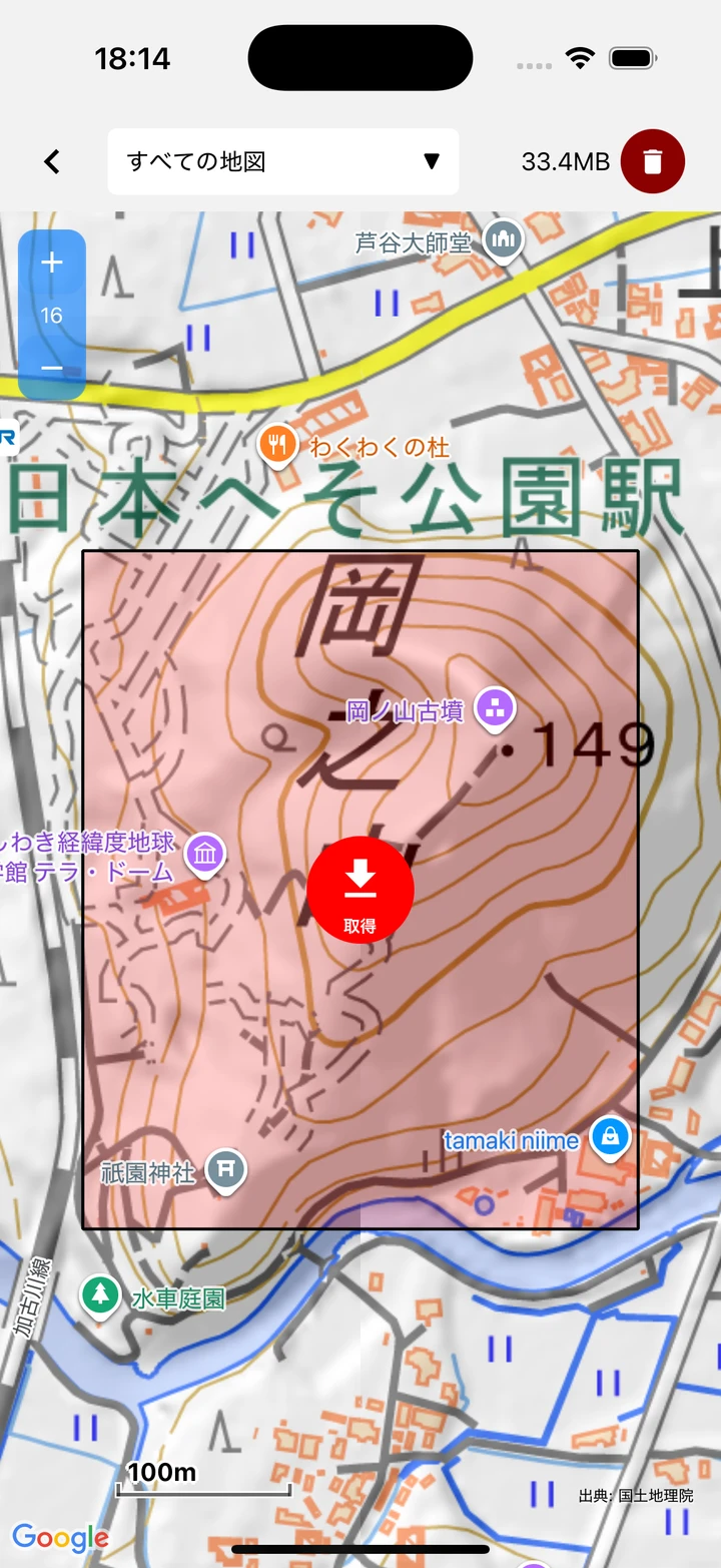
- Enter download mode with “Download” at the top right of the Map selection screen, and choose the target from the map name dropdown at the top. Checking multiple maps under “Select maps to download” fetches them together; if none are selected, “All Maps” is the target. The dropdown also includes “Elevation tiles (for viewshed)”, which does not appear in the map list (it is also covered by “All Maps”; see Create a Viewshed).
- Move to the area you need and tap the “download” button to download the extent within the red frame at the center of the screen.
- Whether a range can be downloaded is judged per map from the estimated number of tiles. Above about 3,000 tiles the app asks “About X tiles (approx. Y MB) will be downloaded. Do you want to continue?”, and above about 30,000 tiles it shows “The area is too large to download. Please zoom in or reduce the number of selected maps.” Maps with a low maximum zoom, such as the GEBCO bathymetric chart, can be fetched over a wide area at once.
- Raster tiles are obtained from zoom 0 to 16, and vector tiles from the current zoom to 18. If the fixed zoom is smaller than 16, raster tiles stop at that zoom level.
- Already-downloaded areas are shown with an orange frame.
- The storage size (MB) is shown at the top, and the delete button removes that map’s downloaded data.
When you fetch multiple maps, progress is shown like “Map 1/3: map name 45%”. Google maps (Standard map / Satellite image) and PDF maps cannot be fetched together.
Note: You can interrupt a download with “Stop”. Choosing “Pause” lets you resume later from where you left off, and already-downloaded tiles are not fetched again.