 EcorisMap
CHAPTER 09
Draw Points, Lines & Polygons
Select point / line / polygon / memo from the “draw” button to show the editing tools for each.
Editing layer
Points, lines, and polygons are recorded to the “editing layer”. The current editing layer is shown as an orange label at the top of the screen, and tapping it lets you switch layers on the spot (it reads “No layer selected” when none is set).
If no editing layer is set when you select a tool, the app guides you to choose one.
- One candidate layer — it asks “Set ”◯◯” as the editing layer?”.
- Several candidates — the “Select a layer to edit” screen appears. You can also choose “Create a new layer”.
- No candidates — it asks “There are no editable ◯◯ layers. Create a new layer?” and opens the Layer settings screen.
- The editing layer is hidden — it asks “The editing layer ”◯◯” is hidden. Show it and continue?” so you can keep editing.
Point tool
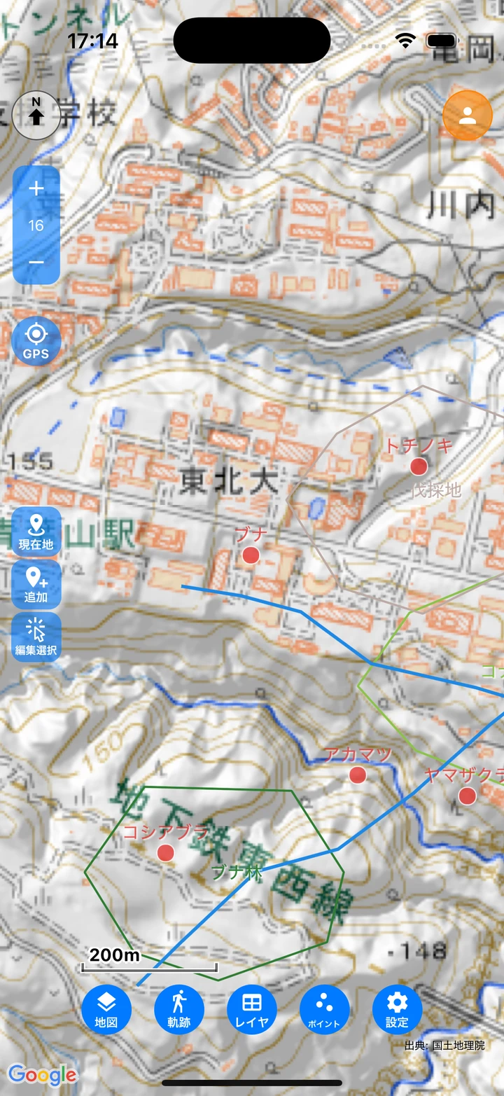
- here — After you confirm “Add a point at the current location?”, the app adds a point at your GPS current location and opens the Data edit screen. When GPS is off, it shows “Please turn on GPS.” (in the web version, this works while the map’s location button shows your current location).
- add — Use this to record a place other than your current location. Places a new point where you tap on the map, and you can drag to fine-tune the position before lifting your finger. Tapping “confirm” at the top of the screen opens the Data edit screen, and “cancel” discards the point.
- move — When you tap a point to select it with “select”, “add” changes to “move”. Drag the point to reposition it.
- select — Tap an existing point to select it and start editing its position. Trace around points to select them all at once: drag inside the dashed frame to move them together, drag the rotation handle above the frame to rotate them, and use the delete button to remove them all.
Line tool
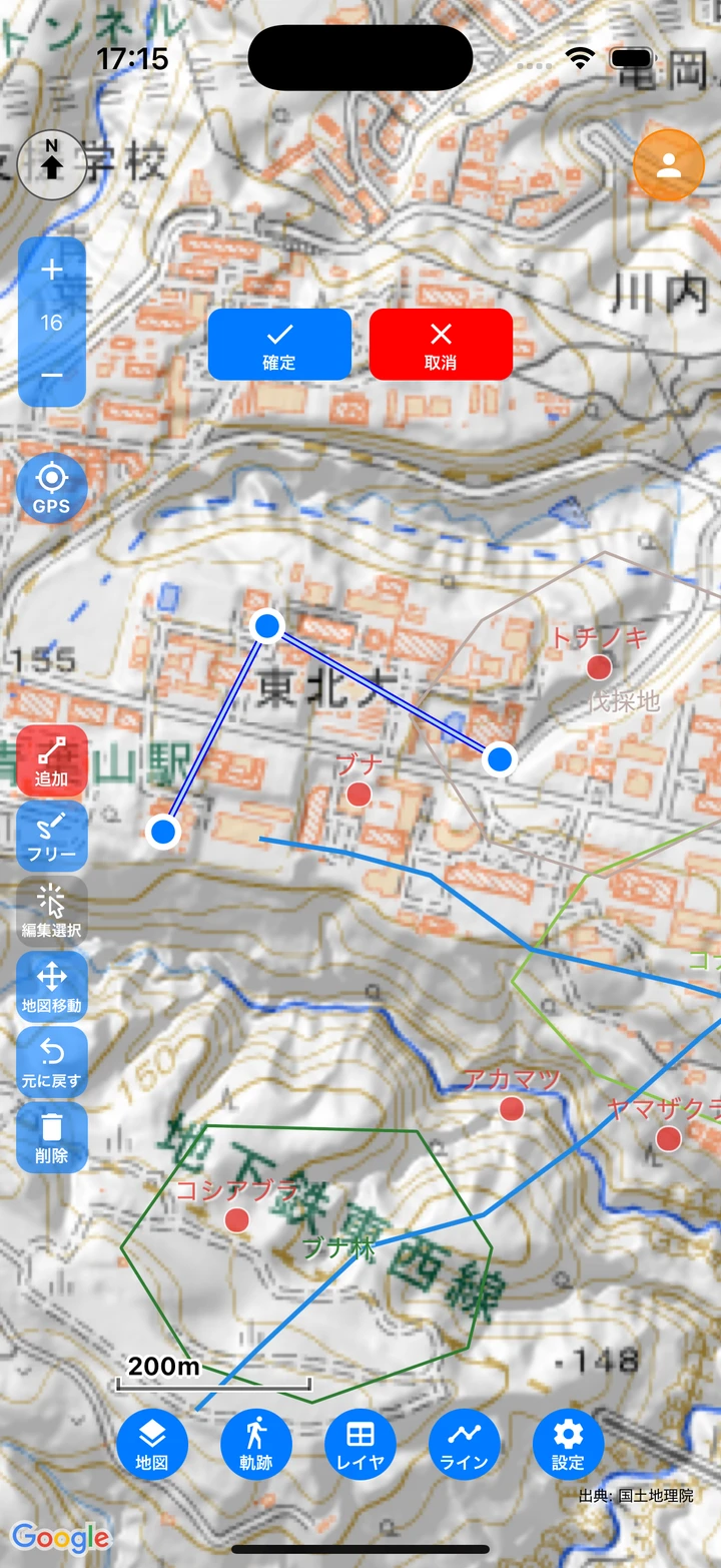
- add (plot) — Tap the map to add vertices (nodes) in order.
- Drag a node to move it. Tap on the line to insert a node, and lightly tap a mid node to delete it (the start point cannot be deleted).
- Tapping “confirm” with two or more points saves the line and opens the Data edit screen.
- pen (handwriting) — The path you trace by dragging becomes a line, with shake correction applied automatically. Draw one line and save it with “confirm”. Trace near the drawn line to redraw and modify that part. While drawing, the map does not move and the stroke is never lost (switch to “Map move” to move the map).
- select — Tap an existing line to start editing that one line (node editing for plotted lines, tracing to modify for handwritten ones). Trace around lines to select them all at once, then move, rotate, or delete them together just like points.
Polygon tool
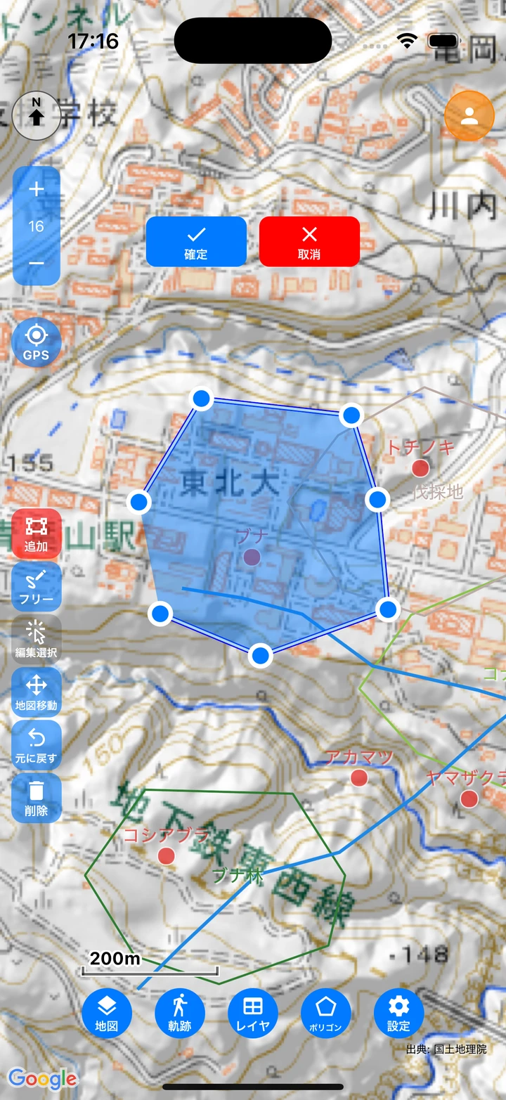
- The operation is the same as for lines, with two kinds: “add (plot)” and “free (handwriting)”.
- With plot, place three or more points and tap the starting node to close and confirm (or use the “confirm” button).
- With free, the shape closes automatically even if the start and end points are apart.
- Selecting works the same as for lines: tap to edit one polygon, or trace around several to move, rotate, or delete them together.
Color and width (layers with “Individual” color type)
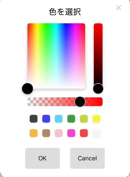
When the layer’s color type is “Individual” (see Change the Style), a “style” button appears. Set the width, arrow (lines only), and color on their tabs and apply them with “OK”. The settings are used for the lines and polygons you draw next, and changing them while a feature is selected applies to that feature.
Layer purpose (tool palette)
Layers with a “Purpose” set in the layer settings show a tool palette tailored to that purpose (see Create a Survey Form).
- Vegetation map (polygon) — Choose a vegetation category with the “植生区分” (vegetation category) button before drawing, and the category value and color are filled in automatically. You can also add categories and change their colors on the spot.
- Flight map (line) — For raptor flight surveys. Available with an organization account (see Project Features).
Common buttons while editing
- confirm / cancel (top center of the screen) — Two buttons with the label below the icon. They save or discard the editing content. For shapes that cannot be saved (a line with only one point, a polygon that cannot be closed, etc.), an error is shown.
- Map move — While a drawing tool is active, the map cannot be moved, so switch to this button when you want to move it (your work in progress is kept). While on, touches pan the map and nothing is drawn, and you can also move the map with two-finger operation. Tap it again to return to the tool you were using; “confirm” and “cancel” remain available while the map is being moved.
- undo / redo — Undoes the previous operation one step at a time, and redoes what you undid. The buttons appear only when they can be used.
- delete — Deletes the selected features — all of them when multiple features are selected (with confirmation).
- lock — A mode for drawing only with the Apple Pencil (shown on iPad only). Finger touches become map operations.
Once you start editing, “select” is replaced by “Map move”. The other tools stay visible and are greyed out when they cannot be used, rather than disappearing. While you are moving or rotating features selected by tracing around them, the tools and tool palettes unrelated to that operation cannot be pressed (“confirm”, “cancel”, “undo / redo”, “delete”, and “Map move” stay available).
Map memo
A tool for scribbling directly on the map. Memos are saved to the dedicated “Memo” layer, so they never mix into your survey data layers.
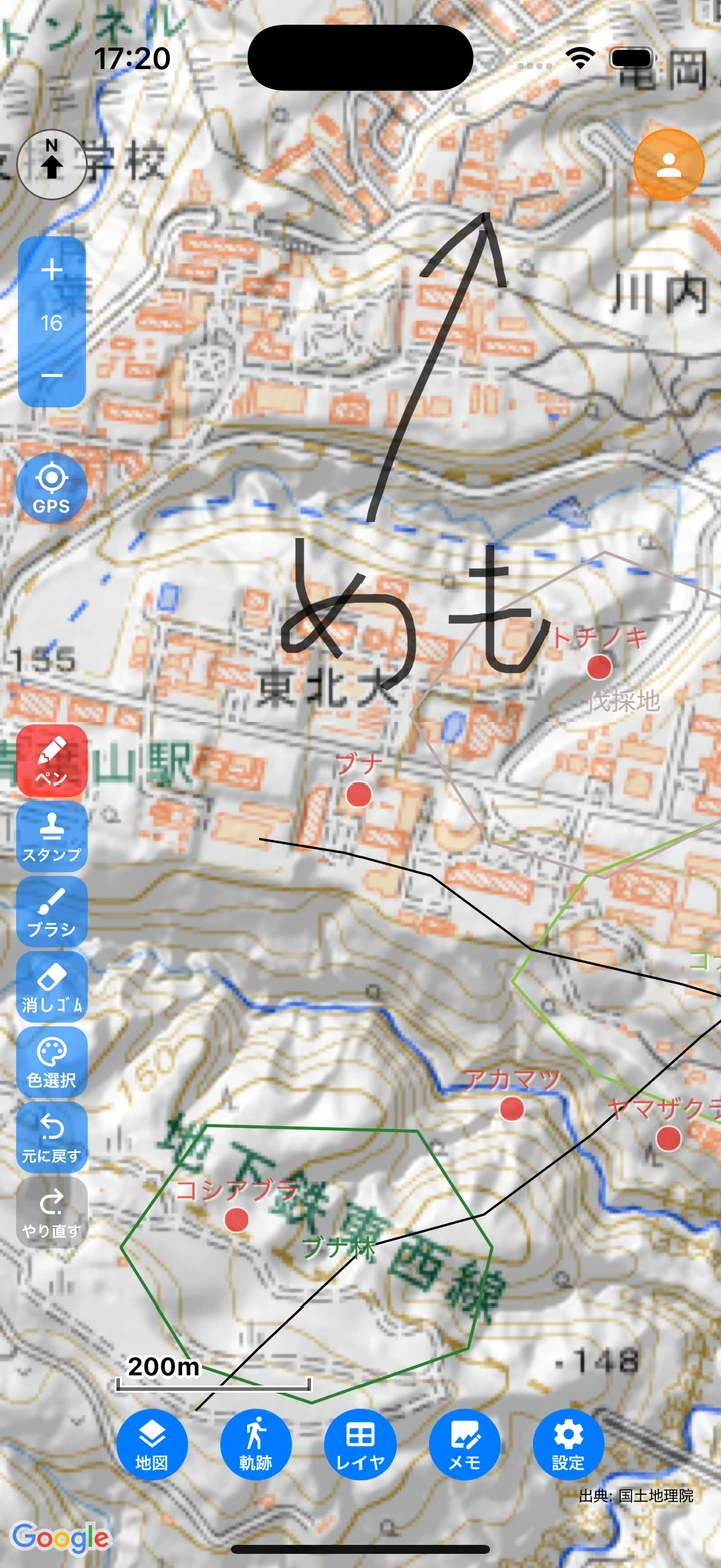
- pen — Drag to draw a line. Tap the button again to turn it off.
- eraser — Erases only the part you trace.
- width — Each tap cycles thin → medium → thick → extra thick.
- curve / straight — Tap to switch how you draw. Shake correction is applied automatically to curves.
- arrow — Each tap cycles none → end → both.
- color — Selects the pen color by hue, saturation, brightness, and transparency.
- undo / redo — Undoes and redoes your drawing, including partial erasing. The buttons appear only when they can be used.
- lock — Apple Pencil-only mode (iPad only).
While the pen or eraser is on, the map cannot be moved. To move the map, tap the pen (or eraser) again to turn it off.
Memo data
Map memos appear in the Data list as data of the “Memo” layer, and you can export them. The line width (_strokeWidth), color (_strokeColor), line kind/arrow (_strokeStyle), and the zoom level when drawn (_zoom) are saved as fields.
Correcting the position
Tapping “Position” on the Data edit screen lets you edit that data’s location on the map. Move a point by dragging or tapping it (for data without location information, the place you tap becomes its position), or redraw a line or polygon with plot or handwriting. Confirming returns you to the Data edit screen; “Back” discards the edit.