 EcorisMap
CHAPTER 09
Look Up Feature Info
Displaying feature attributes
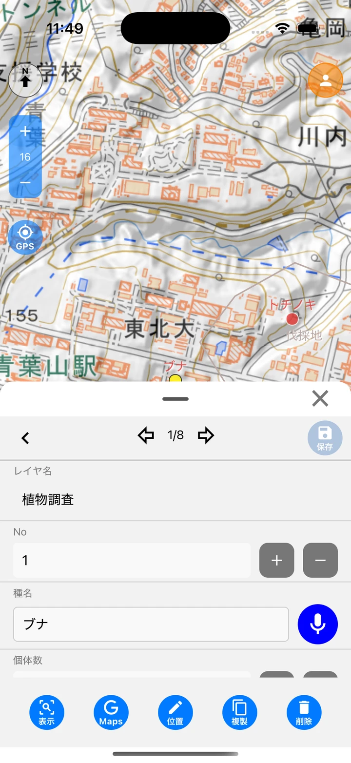
- Tap a feature on the map (point, line, or polygon) to show its attribute information in the sheet at the bottom of the screen. This sheet is the Data edit screen.
- Use the arrow buttons at the top of the sheet to switch to the previous or next data within the same layer.
- Swipe to adjust the display area to three levels. Close it with the × button.
Note: While a draw tool is in use, tapping is treated as an editing operation. To view attributes, select “draw” in the draw menu to turn the tool off.
Feature info popup
Tapping a feature on a vector tile map shows a list of its attributes in a popup. Close it with the × at the top right.
Other info popup
Long-press the map (about 0.8 seconds) to show that point’s information in a popup, even where there is no feature. Tapping a POI (place or facility name) on a Google map shows the same popup.
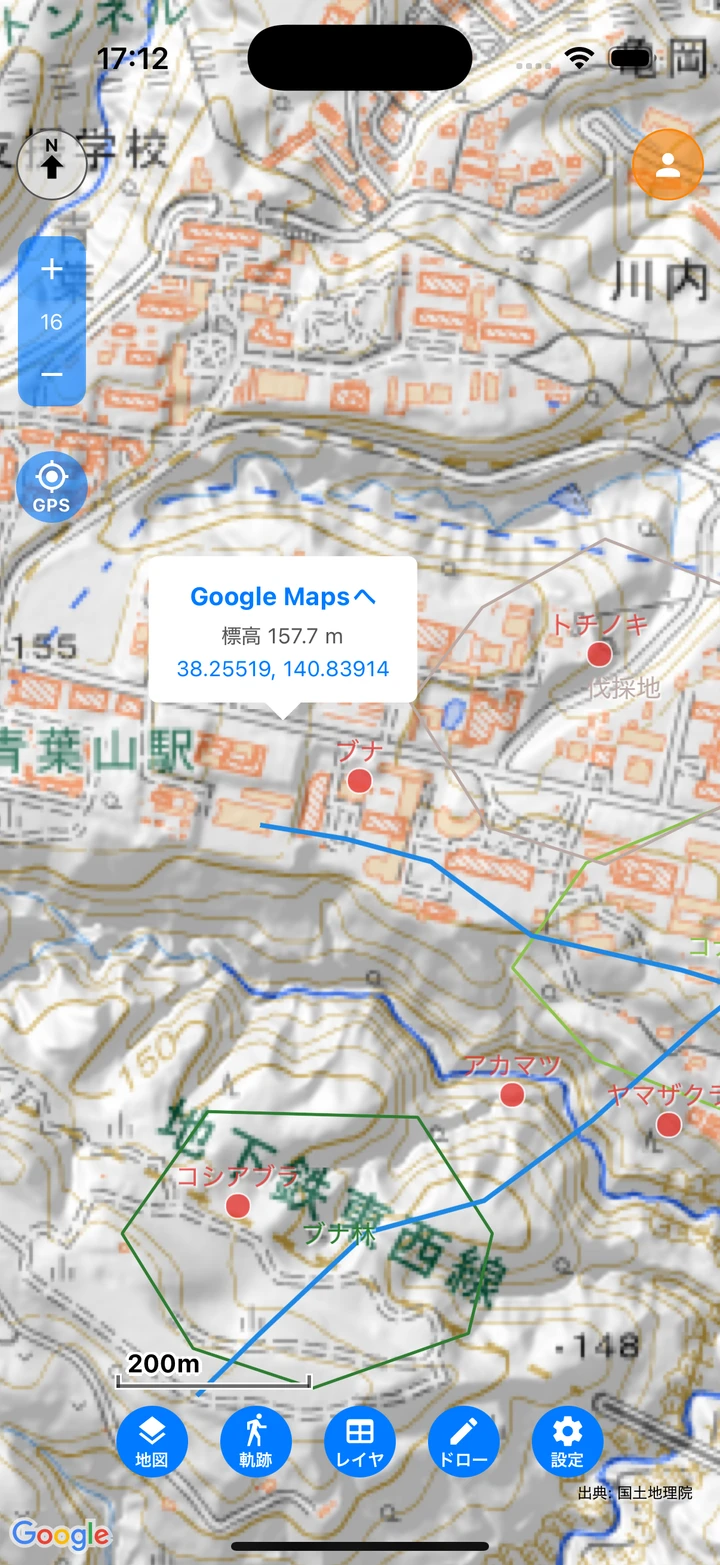
- To Google Maps — Opens that point in the Google Maps app. Useful for route directions and more.
- Distance from current location — When GPS is on, shows the straight-line distance from your current location (only on long-press; distances under 1km are shown in m).
- Elevation — Shows that point’s elevation using the GSI elevation API. Where it cannot be obtained, “Elevation unavailable” is shown.
- Coordinates — Shows the latitude and longitude to 5 decimal places. Tapping copies them and shows “Copied”.